ACSOE example trajectory plots
The BADC provides the ACSOE community with plots of clusters
of forecast and actual trajectories which are used for planning
and analysis purposes. During the 1996 campaigns three air-parcel
arrival sites were adopted: Mace Head in South West Ireland; Weybourne
off the Norfolk coast and a North Atlantic site representative
of the position of the ship. Four different plot formats were
used:
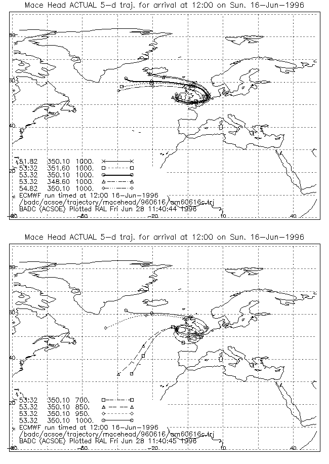
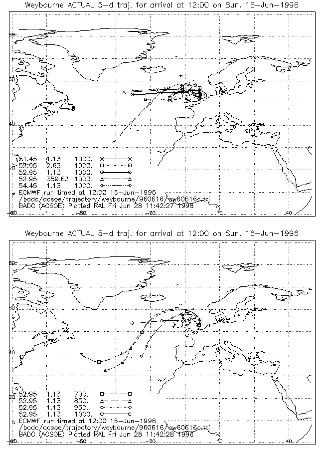
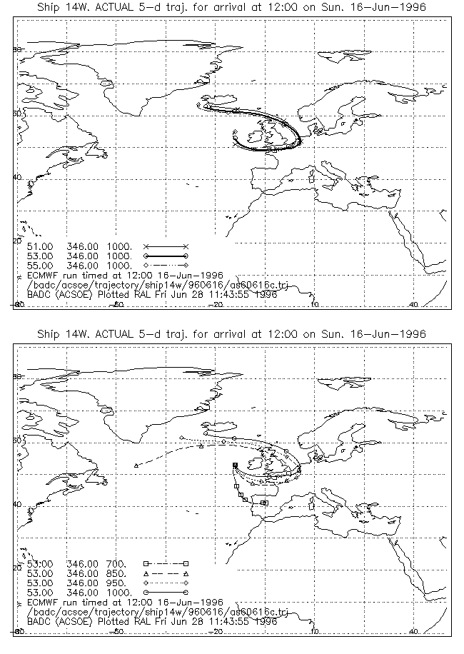
- PLOT 1: Summary Plot
Two maps on a single A4 portrait-size page. One
map (top) for the centre of the cluster with trajectories arriving
at four pressures (700, 850 950 and 1000mb). One map (bottom)
for the 1000mb pressure with trajectories arriving at the five
horizontal co-ordinates.
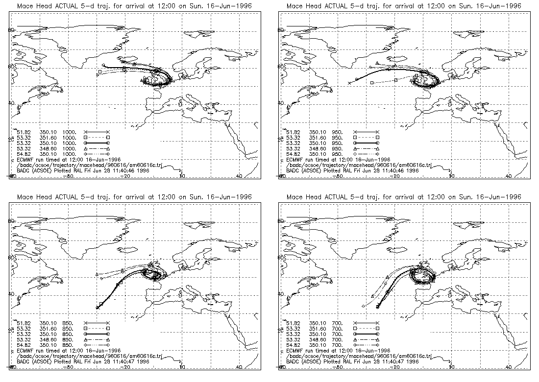
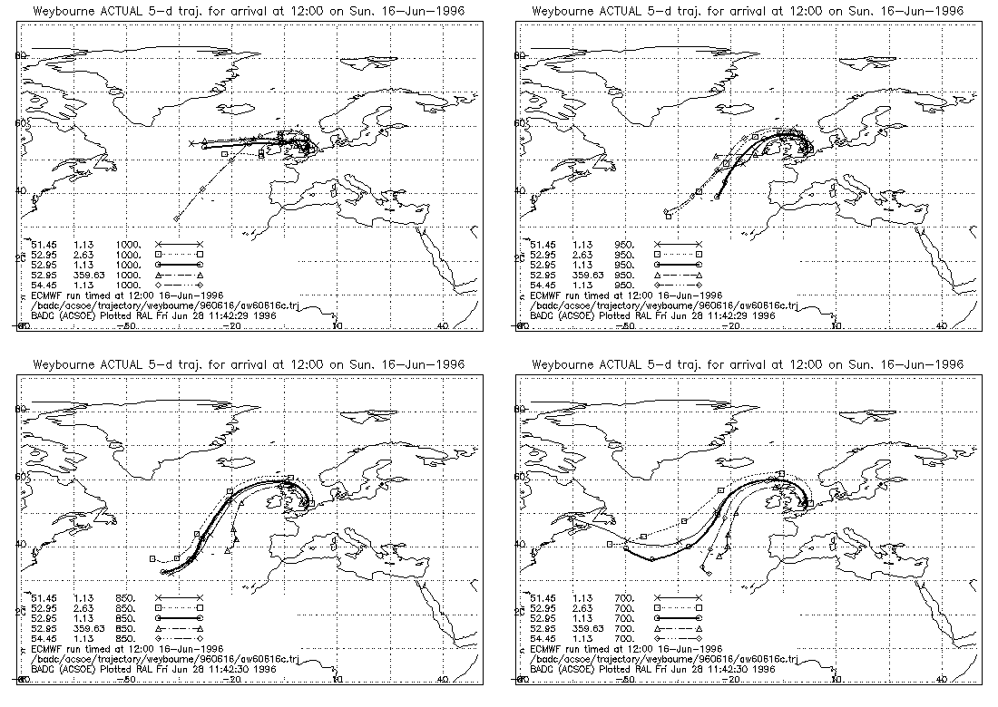
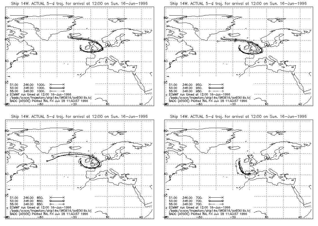
- PLOT 2: Horizontal variability
Four maps on a single A4 landscape-size page. One
map for each pressure with the trajectories arriving at five
horizontal co-ordinates.
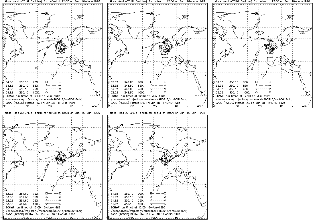
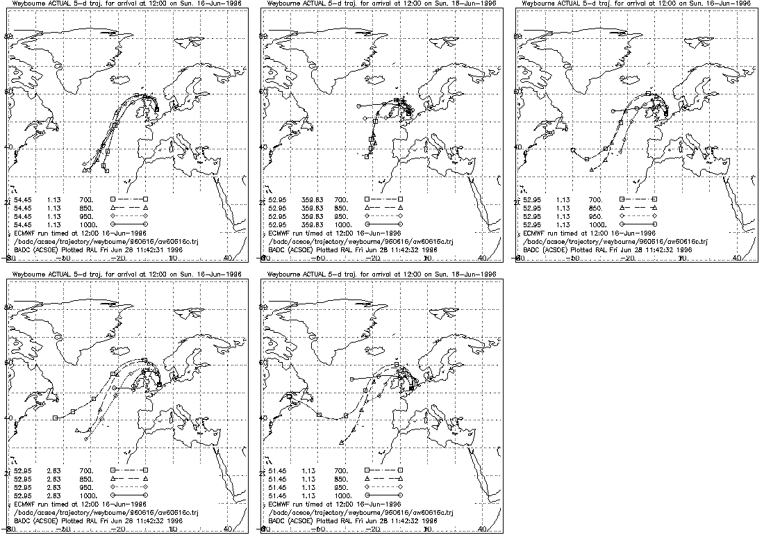
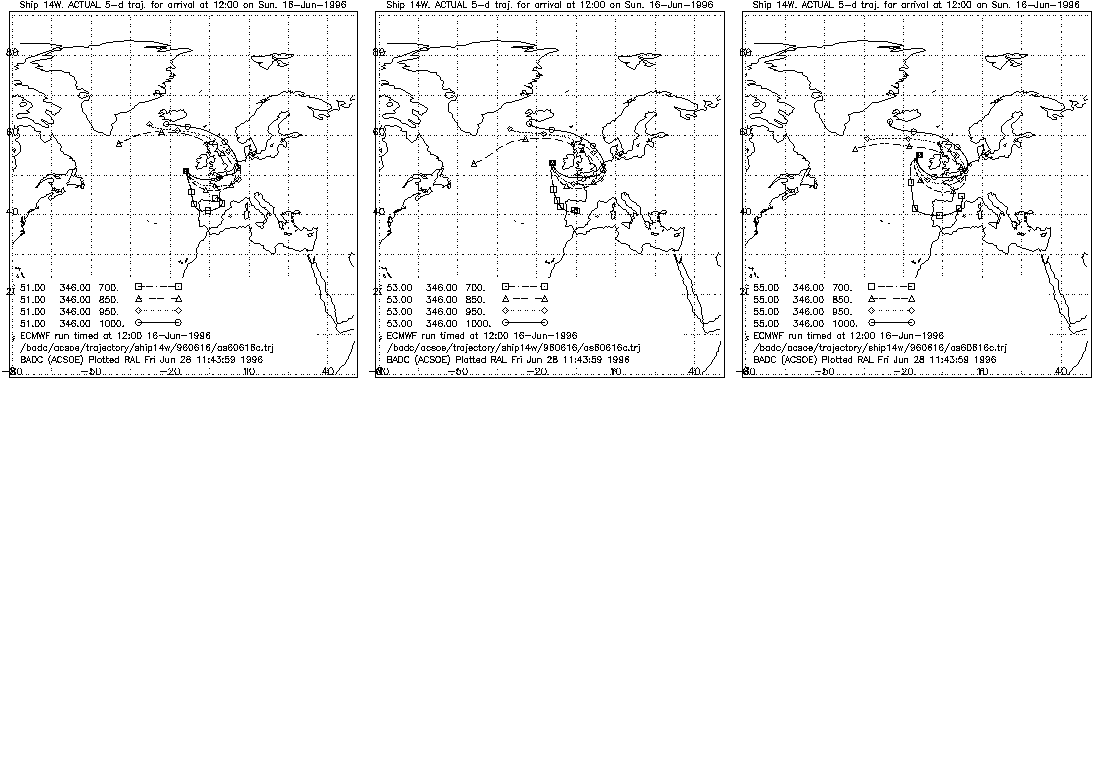
- PLOT 3: Vertical variability
Five maps on a single A4 landscape size page. One
map for each horizontal co-ordinate with trajectories arriving
at four pressures.
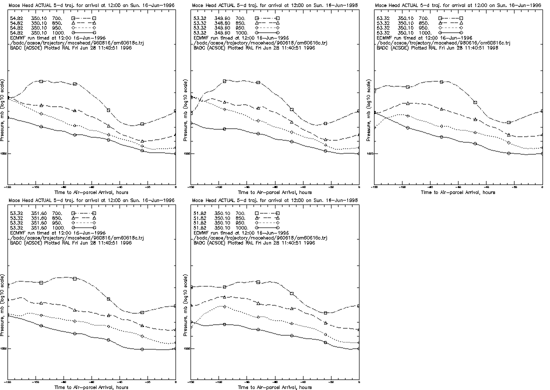
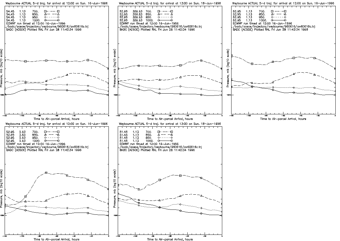
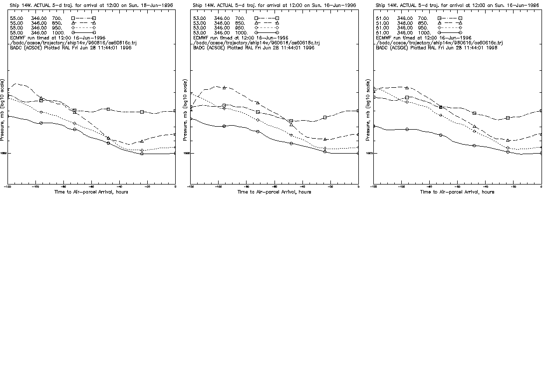
- PLOT 4: Time series
Five time series on a single A4 landscape size page.
One time series per horizontal co-ordinate showing "pressure
height" (inverted log) as a function of time for each arrival
pressure.
Example plots showing air-parcel arrival at 12:00 on June 16,
1996 are available for: