
The ATSR Project
|

ATSR Average Sea Surface Temperature Products
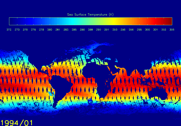
The ASST products have been arranged year by year from the beginning of the ATSR-1 mission in August 1991 up to and including June 1995. Maps will become available as ATSR-1 data is re-processed. Presently only a small number of maps have been produced and these are for the year 1994. GIF files are available:
![]() ATSR-1 ASST Images for year 1994
ATSR-1 ASST Images for year 1994
![]() ATSR-1 ASST Images for year 1995
ATSR-1 ASST Images for year 1995
![]() ATSR-1 ASST Images for year 1996
ATSR-1 ASST Images for year 1996
Related Links
![]() Get
all the ATSR-1 ASST images combined in one animation.
Get
all the ATSR-1 ASST images combined in one animation.
 Download the ASST products as generated by SADIST processing

Page last modified : Thursday, 06-Dec-07