
The ATSR Project
|

 |
This is a 3.7 micron images showing the latest calving of the Ross Ice Shelf. The newly calved iceberg, C-19, can be clearly seen. Also note, its predecessor, C-18, which calved sometime earlier. |
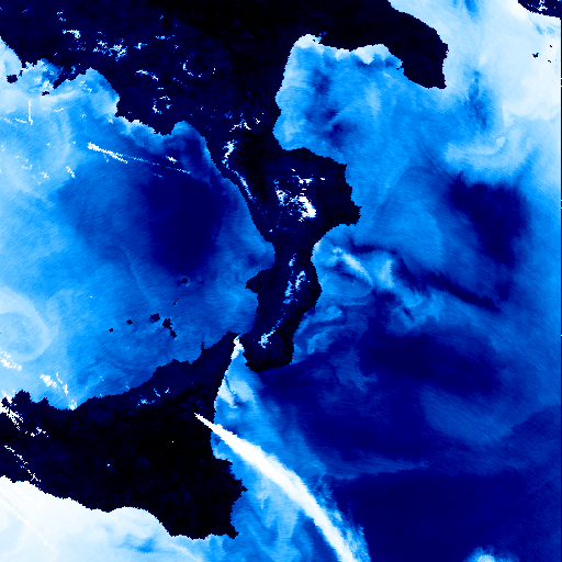 |
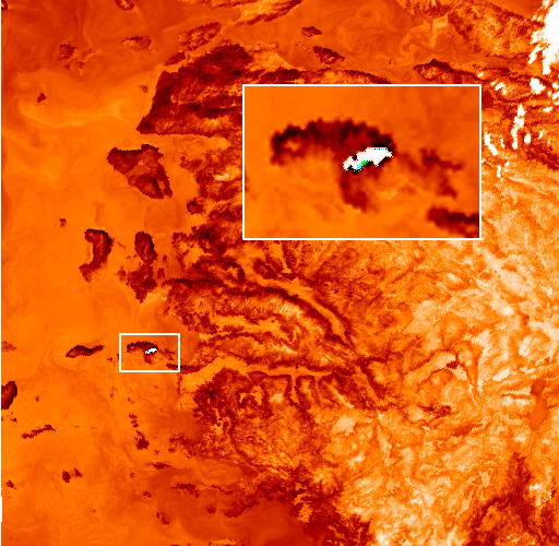
This striking image of eruption on Mount Etna was obtained on 24th July 2001. The plume is clearly visible. The Mount Etna volcano comes to life every few months, but the current eruption started on 17th July. |
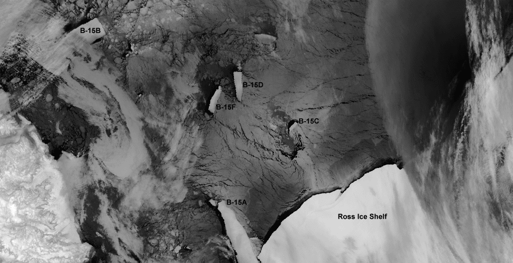 |
This is a 12 micron thermal image, showing the continued break-up of the B-15 iceberg with significant developments over the summer months. Note how far apart B-15A and B-15B have become and how B-15A has swung out into the Ross Sea as it runs into Ross Island. It is also interesting to see that B-15B has moved further out into the Ross Sea, making its way towards ice free waters of the Southern Ocean. The question is - will it escape before the winter freeze sets in? This image was taken on the 2nd April 2001.
|
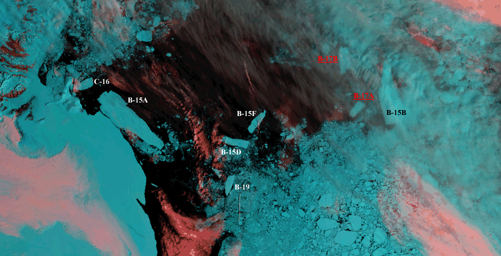 |
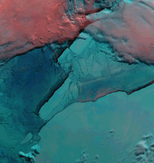
B-17 has recently broken in half and The National Ice Center reported this as occurring on the 30th December 2000. The image below is a visible day image combining 1.6, 0.86 and 0.67 microns. The different icebergs are annotated with B-17A and B-17B clearly labeled. It is also interesting to note the growing distance between B-15F and B-15B in a relatively short space of time, with B-15B drifting further away from the Ice Shelf. This image was taken on the 5th January 2001. |
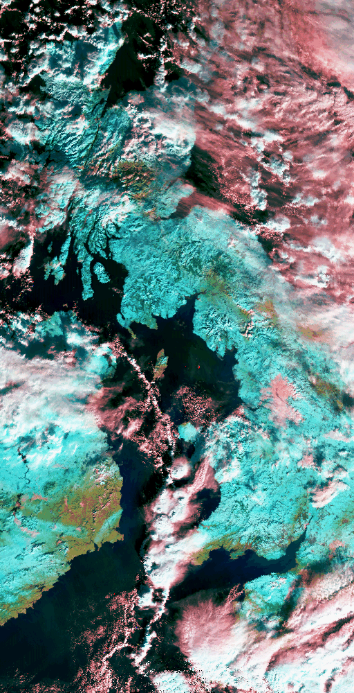 |
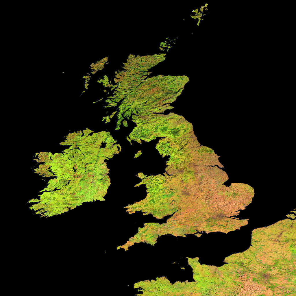
This is a visible day time image combining 1.6, 0.87 and 0.67 microns, showing the recent extensive snow falls that covered much of the UK. The image has been histogram equalized to enhance the areas of snow fall which appear blue, whilst the green patches, such as south east Ireland indicate snow free areas. The white and pink pathces are areas of cloud. This image was taken on the 29th December 2000 |
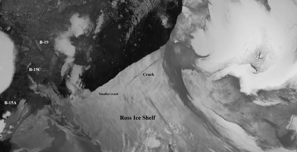 |
The above image clearly shows cracks appearing in the eastern end of the Ross Ice Shelf in the Antarctic, which are better known as 'rifts'. This image was taken on the 21st December 2000 |
 |
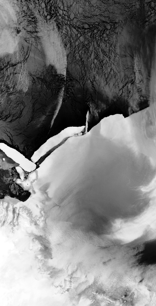
This is a visible day time image combining 1.6, 0.87 and 0.67 microns, showing the continued break-up of the B-15 iceberg. It appears that there is perhaps a new iceberg (B-15F) that has broken from the B-15B iceberg. This image was taken on the 7th December 2000. |
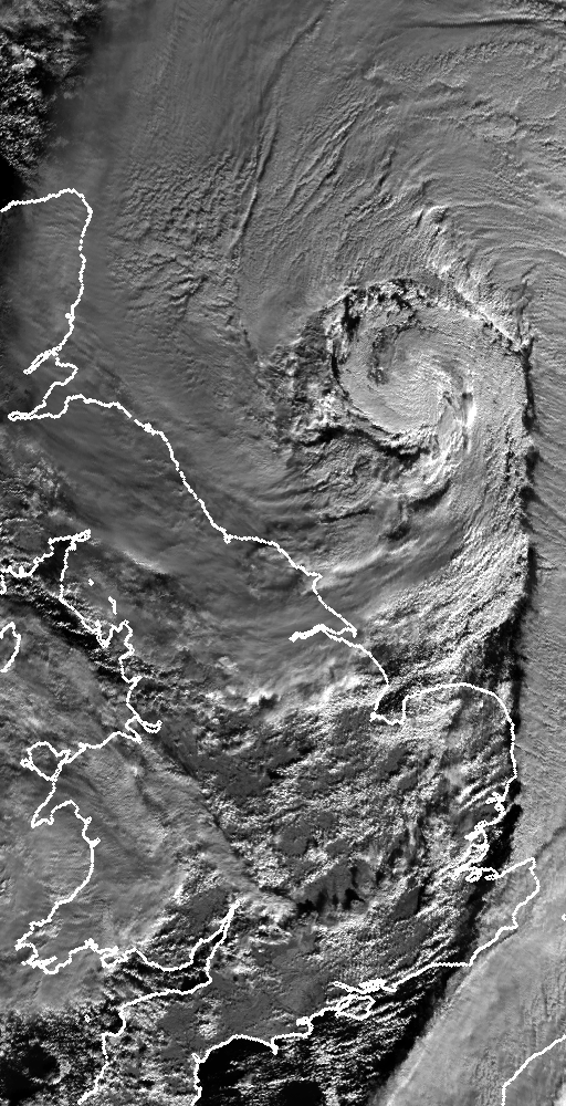 |
This is a day-time 12 micron thermal image, showing the storm over the North Sea, which passed over England and Wales causing widespread disruption across the country, with more rain forecast during the next few days. This image was taken on 30th October 2000 |
 |
A visible day time image combining 1.6, 0.87 and 0.67 microns, showing the continued break-up of the B15 iceberg. This image was taken on the 15th October 2000. |
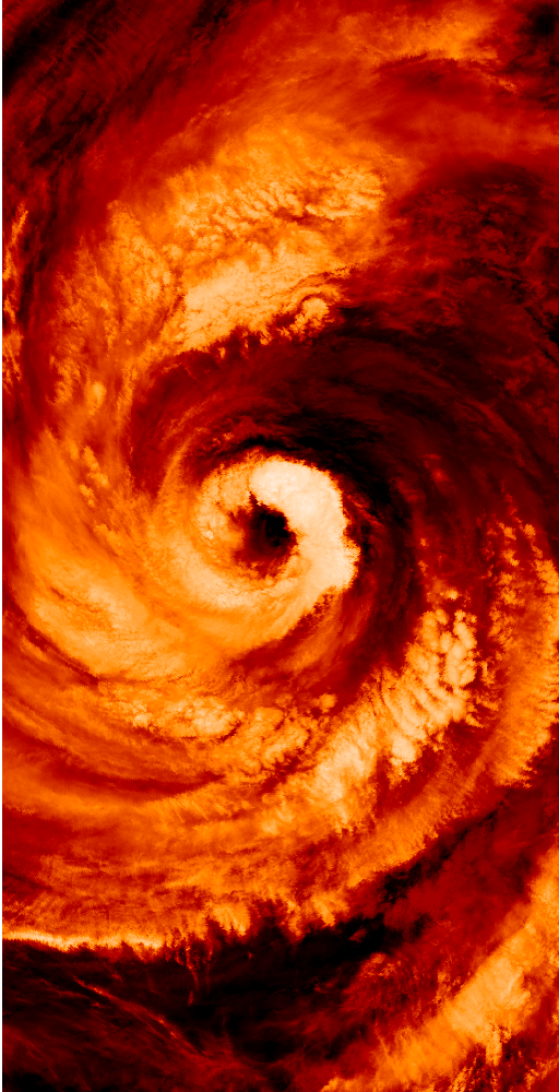 |
This is a night-time 11 micron false colour image, showing typhoon Saomai over the East China Sea, heading North towards the Korean Peninsular. This image was taken on 13th September 2000. |
 |
This is a colour composite image of the forest fires presently raging in numerous US states. The image was obtained from ATSR-2's nadir view, during a day-time pass of the northwest States of Idaho and Montana. In this representation there is a clear distinction between the cloud (white) and the smoke from the fires (blue), whilst forested areas appear green. |
 |
This is a night-time 3.7 micron false colour image from 9th July 2000, showing the coast of Turkey and some of the Greek Islands. A cloud of warm smoke is clearly visible over the island of Samos, scene of severe fires over the past few days. |
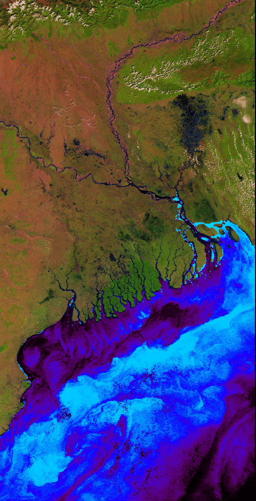 |
This is an ATSR-2 image of the Ganges Delta, created by overlaying a visible (land) image over a thermal (sea) image using the land flag as a mask. |
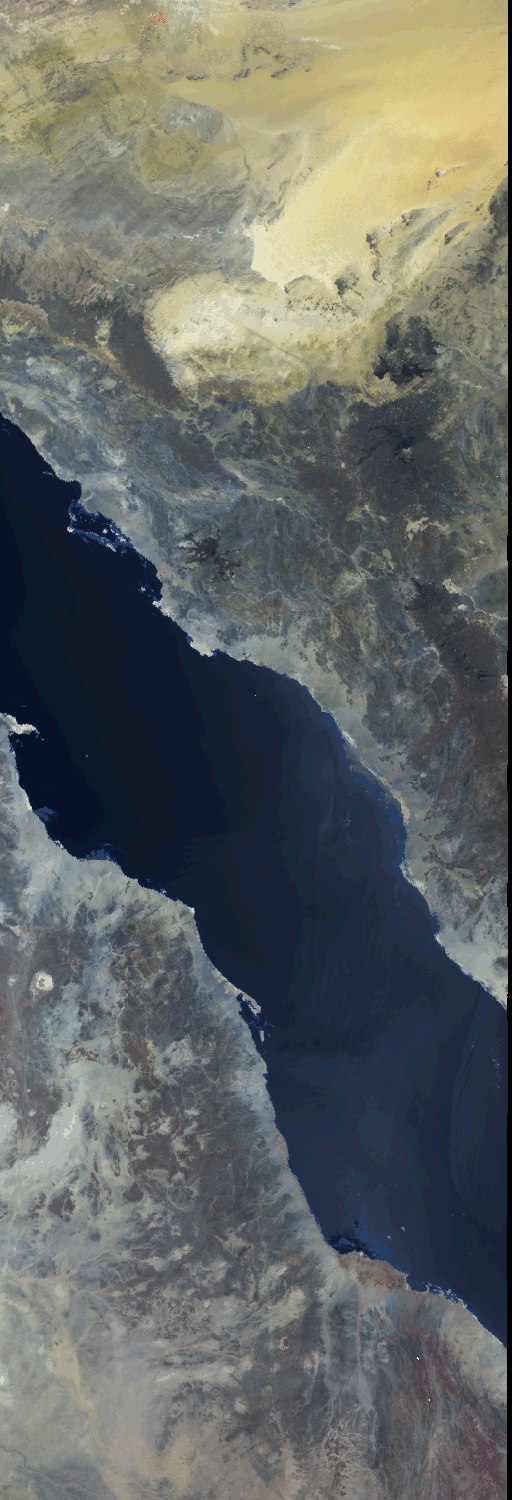 |
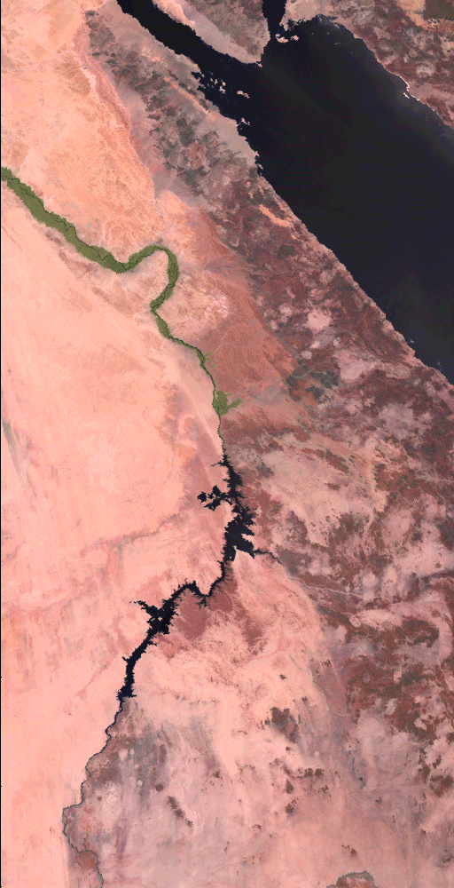
This image is a false colour composite, produced by combining uncalibrated detector counts from three of ATSR-2's detectors: 1.6um near-infrared channel (as red component) 0.87um visible channel (as green component) 0.67um visible channel (as blue component) The strip of water in the middle of the image is the Red sea. On the left of it are the north eastern countries of Africa. These include, Egypt, Sudan and Ethiopia. On the right of the Red sea is Saudia Arabia. |
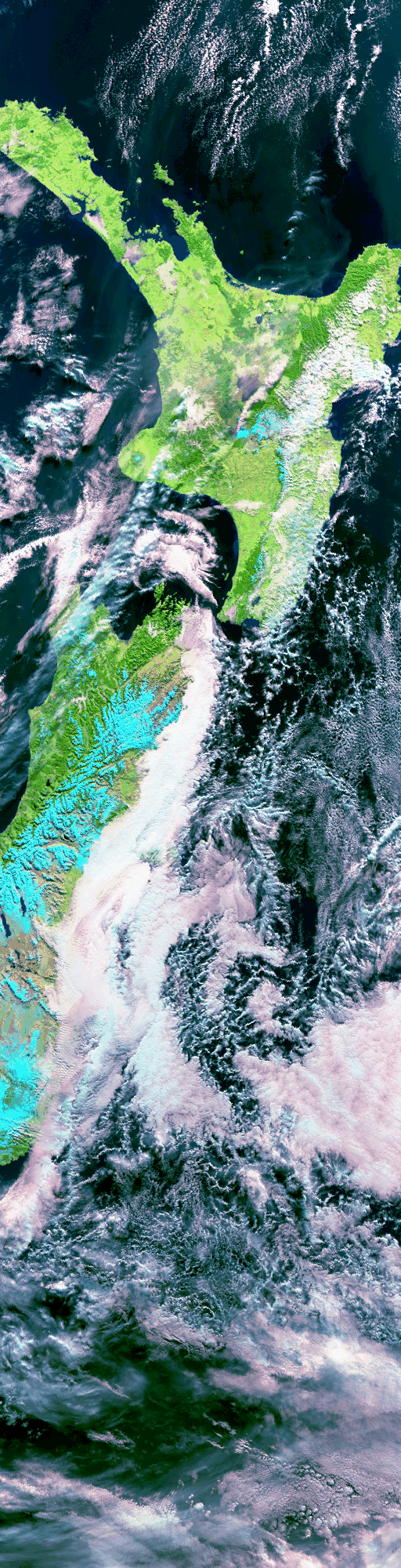 |
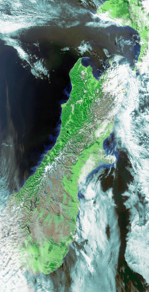
This image is a false colour composite, produced by uncalibrated detector counts from three of ATSR-2's detectors: 1.6um near-infrared channel (as red component) 0.87um visible channel (as green component) 0.67um visible channel (as blue component) The image was obtained from ATSR-2's nadir view, during a day-time pass of New Zealand. Volcanoe Ruapehu's plume can just still be identified. |
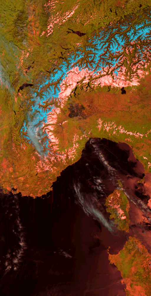 |
This image is a false-colour composite, produced by combining uncalibrated detector counts from three of ATSR-2's detectors: 1.6um visible channel (as red component) The image was obtained from ATSR-2's nadir view, during a day-time pass of the Alps and the Mediterranean Sea. To the north of the Alps, Lake Geneva and Lake Constance are clearly visible. In this representation, there is a clear distinction between those areas of the Alps which are cloud-free (blue: the northern and western Alps) and those (white: the southern and eastern Alps) in which solar heating is creating convective cloud.
PRODUCT NAME: ALPS-9505230953-14841-950608-T002.GBT-TV |
 |
This image was collected on the 24th September 1997 by the UK's Along Track Scanning Radiometer-2 (ATSR-2) on board the European Space Agency's ERS-2 Satellite. The image is a false colour composite of visible channel data from the ATSR-2 processed by the ATSR Project Team at the Rutherford Appleton Laboratory. The image is 512 by 1010 km at a spatial resolution of approx 1km. and covers Borneo and clearly shows the plume of smoke eminating from fires in this area. In the bottom left of the image the SE tip of the island is visible ( the town Banjarmasin is in the visible green area of land). borneo_bright.gif shows the smoke in yellow and low cloud associated with it in creamy yellow, and the higher cloud as white and bluish-mauve. |
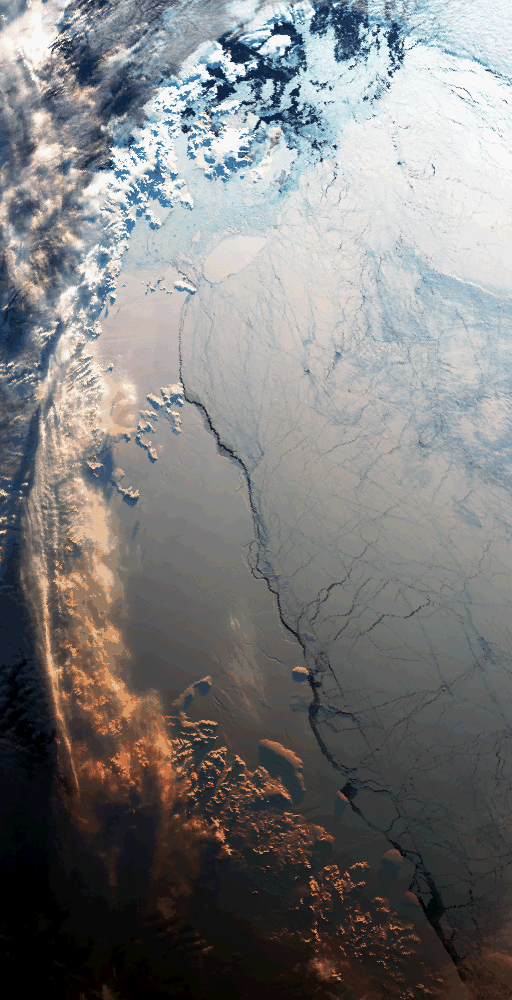 |
IMAGE DATE: 30th April 1995 This image is a false-colour composite, produced by combining uncalibrated detector counts from three of ATSR-2's detectors: 0.87um visible channel (as red component) The image was obtained from ATSR-2's nadir view, during a day-time pass of the area around the Larsen Ice Shelf, part of the Antarctic Peninsula. The dividing line between the ice shelf and the sea ice is clearly visible running from the bottom right up through the centre of the image. The oval-shaped piece of ice at the northern extremity of the ice shelf is a large iceberg formed from the disintegration of part of the shelf. This iceberg, about the size of Oxfordshire, was first seen in February 1995 and has since moved approximately 50km further north. This image has been enhanced to compensate for the low levels of light in the Antarctic at this time of year. The low sun angle can be seen from the long shadows cast by the areas of land onto the ice sheet. The area at the bottom left of the image is already in darkness.
PRODUCT NAME: LARSEN-9504301157-27537-950516-T002.GBT-V |
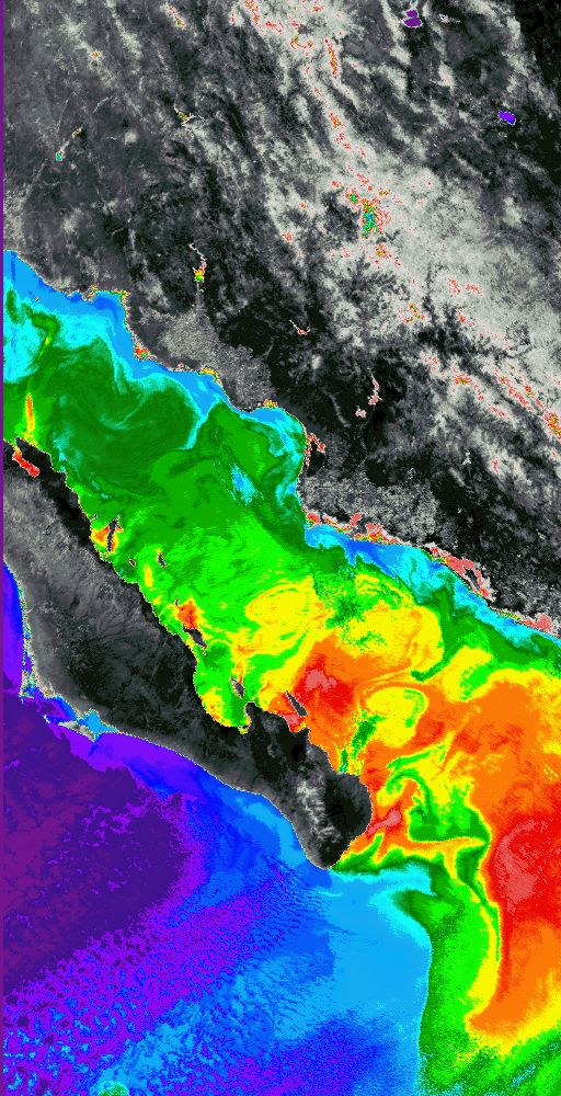 |
This is a false colour image, produced using brightness temperatures from one of ATSR-2's thermal infra-red detectors (11.0 micron). The image was obtained from ATSR-2's nadir view, during a day-time pass of the Gulf of California. The hottest areas (shown in grey) are mostly land. The cooler sea-surface temperatures are shown using purple (coolest) to red (warmest). The range of temperatures shown in the image is approximately 280 Kelvin to 300 Kelvin. PRODUCT NAMES: CALIFORNIA-9505121721-17000-950523-T002.GBT-TV |
 |
This is a false colour image, produced using brightness temperatures from one of ATSR-2's thermal infra-red detectors (11.0 micron). The image was obtained from ATSR-2's nadir view, during a day-time pass of the Canary Islands. The hottest areas (shown in black) are land, and the coolest areas (shown in white and blue) are mostly cloud. The sea-surface temperatures are shown using green (coolest) to red (warmest). The range of temperatures shown in the image is approximately 283 Kelvin to 315 Kelvin. Of particular interest in this image are the clouds formed by the turbulent flow of air across the Canaries. Note also the significant increase in sea-surface temperature on the leeward sides of the islands. PRODUCT NAMES: CANARIES_D-9505271108-16627-950608-T002.GBT-TV |
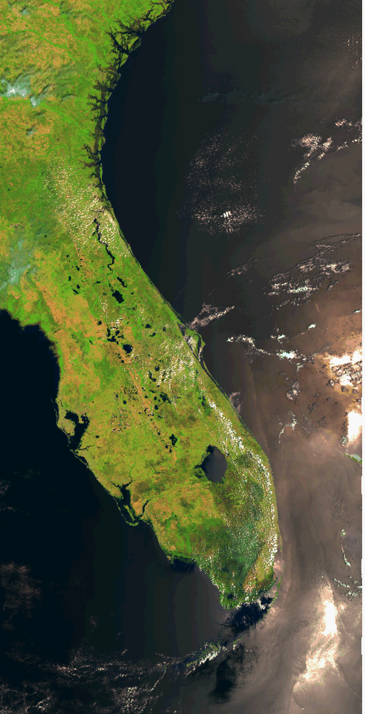 |
This image is constructed from two consecutive false colour composites, produced by combining uncalibrated detector counts from three of ATSR-2's detectors: 1.6um near-infrared channel (as red component) The image was obtained from ATSR-2's nadir view, during a day-time pass of Florida. PRODUCT NAME: FLORIDA_D-9505061529-16400-950802-2T050.GBT-TV |
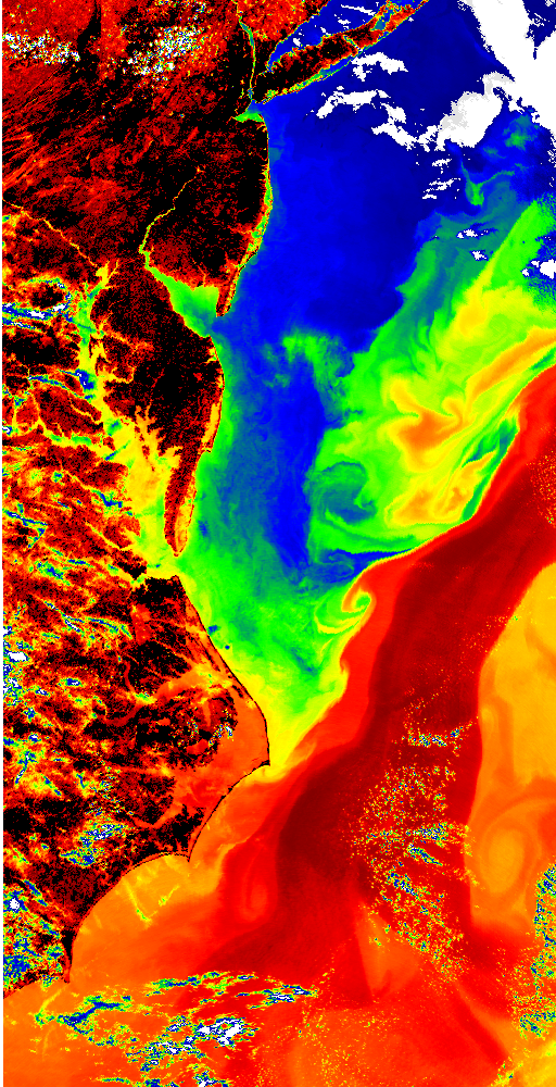 |
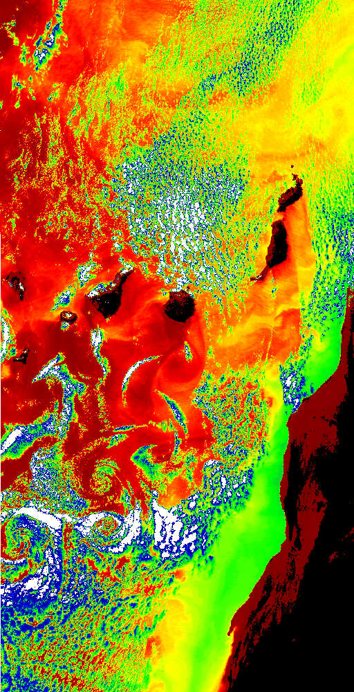
This is a false colour image, produced using brightness temperatures from one of ATSR-2's thermal infra-red detectors (11.0 micron). The image was obtained from ATSR-2's nadir view, during a day-time pass of the United States Eastern Seaboard, from New York (at the top of the image) to Pamlico Sound, North Carolina (at the bottom of the image). The colour scheme shows hottest areas as black (mostly land) and red, and coolest areas as white (mostly cloud) and blue. Significantly warmer than the surrounding water, the Gulf Stream is clearly delineated. The range of temperatures shown in the image is approximately 280 Kelvin to 300 Kelvin. PRODUCT NAMES: US-9505161515-15500-950517-T002.GBT-TV |
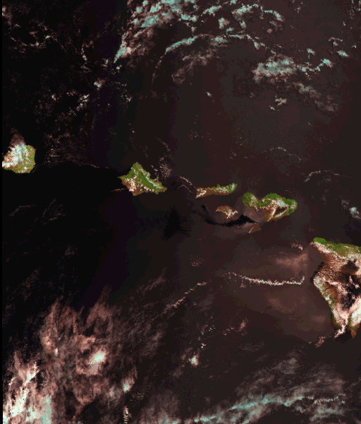 |
The hawaii_vis.gif image is a false colour composite, produced by combining uncalibrated detector counts from ATSR-2's 1.6 micron, 0.87 micron and 0.65 micron channel detectors. The images were obtained from ATSR-2's nadir view, during a day-time pass of the Hawaiian Islands. PRODUCT NAMES: HAWAII-9505222028-17390-950524-T002.GBT-TV |
 |
This image is a false colour composite, produced by combining uncalibrated detector counts from three of ATSR-2's detectors: 1.6um near-infrared channel (as red component)The image was obtained from ATSR-2's nadir view, during a day-time pass of Italy and the Mediterranean Sea. PRODUCT NAMES: ITALY-9505080924-14699-950513-T002.GBT-NTV |
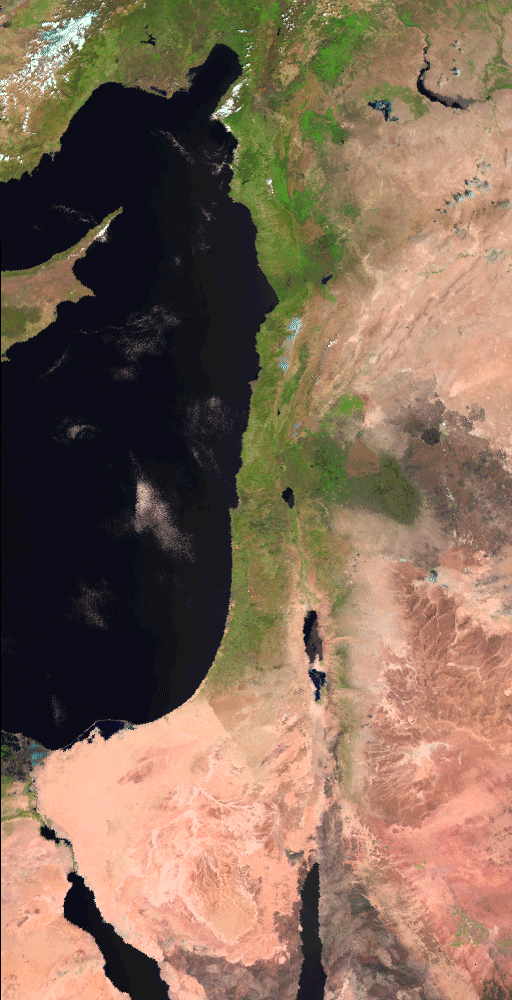 |
This image is a false colour composite, produced by combining uncalibrated detector counts from two of ATSR-2's visible wave-length detectors and the near infrared detector. The image was obtained from ATSR-2's nadir view, during a daytime pass of the Mediterranean Sea, and shows Cyprus, Israel and the Sinai Peninsula. PRODUCT NAMES: MIDEAST-9505110750-16037-950511-T002.GBT-TV |
 |
This image is a false colour composite, produced by combining uncalibrated detector counts from two of ATSR-2's visible wave-length detectors and the near infrared detector. The image was obtained from ATSR-2's nadir view, during a daytime pass over Egypt. PRODUCT NAMES: MIDEAST-9505110750-17037-950511-T002.GBT-TV |
 |
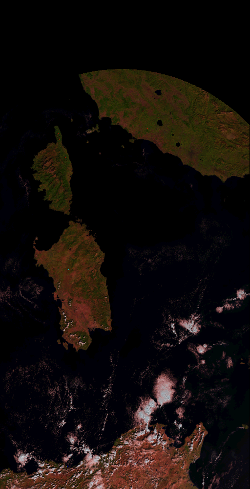
This image is a false colour composite, produced by combining uncalibrated detector counts from three of ATSR-2's detectors: 0.67um visible channel (as red component) The image was obtained from ATSR-2's nadir view, during a day-time pass of New Zealand's South Island. PRODUCT NAMES: NZ-9505012129-24672-950802-2T050.GBT-TV |
 |
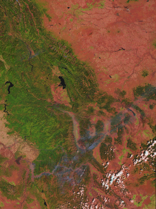
This image is a false colour composite, produced by combining uncalibrated detector counts from three of ATSR-2's detectors: 1.6um near-infrared channel (as red component) The image was obtained from ATSR-2's nadir view, during a day-time pass of Rondonia, in western Brazil. The pale, regular areas in what is otherwise tropical rain forest show the extent of human deforestation, which is considerable in this area. PRODUCT NAME: RONDONIA-9505101323-22500-950511-T002.GBT-TV |
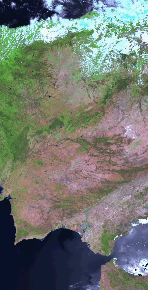 |
This image is a false-colour composite, produced by combining uncalibrated detector counts from three of ATSR-2's detectors: 1.6um visible channel (as red component) The image was obtained from ATSR-2's nadir view, during a day-time pass of the Iberian Peninsula, including most of Spain and Portugal. Note the increased intensity of the signal from the sea-surface towards the right-hand side of the image. This is caused by the reflection of the Sun directly into the instrument view; the Sun is always towards the East during day-time ERS-1 passes, since the satellite orbit is sun-synchronous, and the local time at the southward Equator-crossing is approximately 10:30am. PRODUCT NAME: EUROPE-9505311042-15199-950607-T002.GBT-NTV |
 |
This mosaic is a false colour composite, produced by combining uncalibrated detector counts from three of ATSR-2's detectors: 1.6um near-infrared channel (as red component) The mosaic has been constructed using images from ATSR-2's nadir view, acquired during a sequence of day-time passes of the UK and northern Europe in July and August 1995. AREA: 48N to 61N latitude; 12W to 4E longitude |

Page last modified : Thursday, 06-Dec-07